


Real Estate Aerial Imagery
Our Aerial Imagery can be divided into two different categories of service. We offer both residental/commercial imagery, as well as property imagery. If you are interested in Mapping, please go to the Mapping Page located under the Drone Services tab.
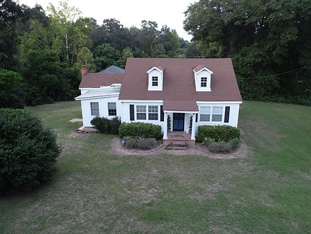

Residential
Property
Residental Aerial Photography is a great way to enhance the selling and promotion of any listing. Both Residental homes and commercial buildings apply to this category.
Below are the listed features for this service:
-
High-resolution photographs with a Phantom 4 Pro UAV
-
Images from a High-Resolution Canon 80D DSLR Camera
-
The option to have edited photos from the highly powerful Adobe Photoshop and Adobe Lightroom
-
All videos can be edited through Adobe Premiere
Property Aerial Imaging can capture a large piece of property in a matter of minutes. By using standard imagery. We can also combine this with our mapping services to give any customer a virtual tour of the property from above. Either 2-D or 3-D mapping services are available on our Mapping page.
Below are the listed features for this service:
-
Detailed images from any elevation up to 400 feet AGL.
-
Complete property fly-overs
-
Mapping services detailing roads, water sources, food plots, and other property features
-
All videos and photos can be edited through a powerful computer and using advanced Adobe Pro software to make the images and videos impressive.

In order to request our services, please contact the number given on the website for a quick quote, or submit the form by clicking on the form button below. All quotes will be given within 24 hours.